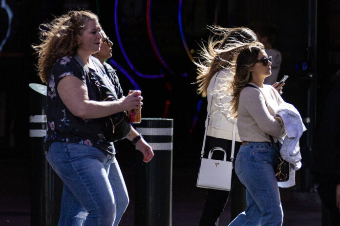
Those noises you heard last night weren’t anything supernatural. It was just the wind. And lots of it.
Parts of the Las Vegas Valley, including Summerlin and Centennial Hills, experienced a turbulent night as powerful winds swept through late Monday and into early Tuesday morning. The National Weather Service reported impressive gusts, with speeds reaching up to 55 mph in North Las Vegas, 52 mph in Red Rock Canyon, and 51 mph in Henderson. Even Harry Reid International Airport recorded gusts of 49 mph, while Nellis Air Force Base and Boulder City Airport weren’t far behind at 47 mph and 41 mph, respectively.
In response to these conditions, the National Weather Service extended its wind advisory for Southern Nevada until 7 a.m. Wednesday, having initially set it to expire at 2 a.m. Tuesday. Residents were informed to expect sustained winds of 20 to 30 mph from the south, with gusts possibly hitting 50 mph.
Semis Rollover
As the winds increased, they had tangible effects on local transportation. Early Tuesday morning, the Nevada Highway Patrol announced a closure of I-11 southbound at Boulder City Parkway due to multiple rollovers of semi tractor-trailers caused by the high winds. By 7 a.m., the freeway had reopened, but not before crews responded to three separate incidents that occurred between 3 and 4 a.m. Trooper Shawn Haggstrom confirmed that the heavy winds were responsible, noting, “These semi tractor trailers rolled over onto their sides due to high wind in the area.” Fortunately, only two drivers required transport to a local hospital for treatment of non-life-threatening injuries.
More Rain Coming
In addition to the fierce winds, the Las Vegas Valley saw a refreshing change in precipitation. On Monday, Harry Reid Airport recorded rain for the first time in about five weeks, totaling 0.03 inches. This was a significant development considering that the last recorded measurable rain happened on January 8 with the same amount. Looking ahead, forecasts indicate that another wave of rain is expected to roll in on Tuesday night and carry into Wednesday, with a 60 percent chance of showers central to the Las Vegas area. A follow-up, albeit weaker, weather system could bring additional moisture on Thursday, though the chance of rain will dip below 50 percent.
As we transition into the cooler months, high temperatures are also expected to fall. The mid-60s will give way to highs in the mid-50s by Thursday, with a slow uptick projected as the weekend approaches. For context, the average high for mid-February stands at around 63 degrees.
For those heading to the mountains, the Spring Mountains and the Sheep Range are under a winter storm warning lasting until 10 p.m. Wednesday. Winter enthusiasts can look forward to significant snowfall, with expectations of one to two feet for elevations above 7,000 feet and six to 12 inches at elevations above 5,000 feet.
February Numbers
February holds a notable distinction in the annual weather narrative for Las Vegas, being the wettest month on average, with 0.8 inches typically recorded. As of mid-February 2026, the average annual rainfall reached 0.92 inches, but only 0.14 inches have been noted this year so far. Comparison with past years adds context; for instance, the airport didn’t see any rain until February 13 in 2025, concluding a remarkable streak of 214 days without measurable precipitation.
For history buffs, February has had its extremes—its wettest month recorded a remarkable 2.89 inches in 1998, while four separate years, most recently in 1977, witnessed no rain at all.
For further inquiries, feel free to reach out to Mark Davis at mdavis@reviewjournal.com.
